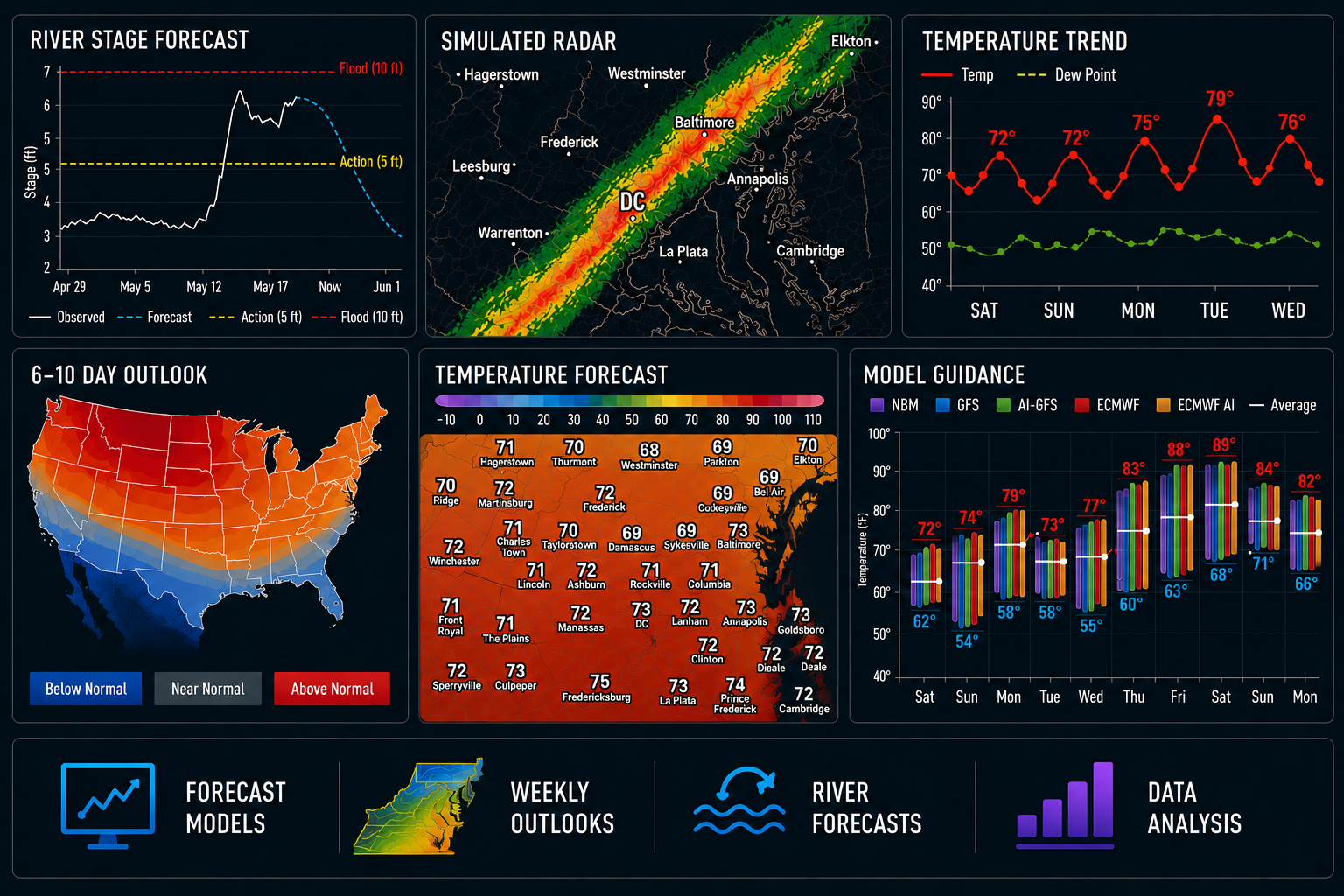
DC-area forecast: Calmer today but with a little smoke. Rain chances return Tuesday.
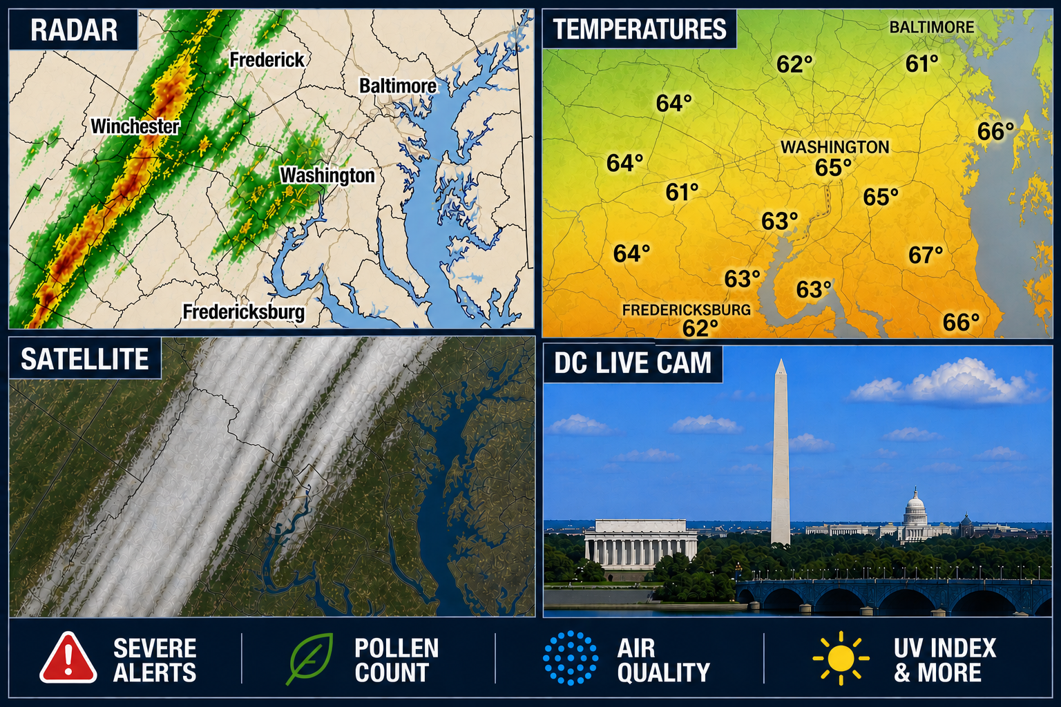
HAPPENING NOW: Some smoke creeps back in from the north late morning into afternoon, but it won't be nearly as thick this time. Decreasing clouds this morning, then mostly sunny and less humid with some haze and highs in the 80s.